アイソメトリックな国家ミニチュアジオラマ(国は差し替え可)
2.5 と 2 の比較;返信内に完全な isometric プロンプトを記載。
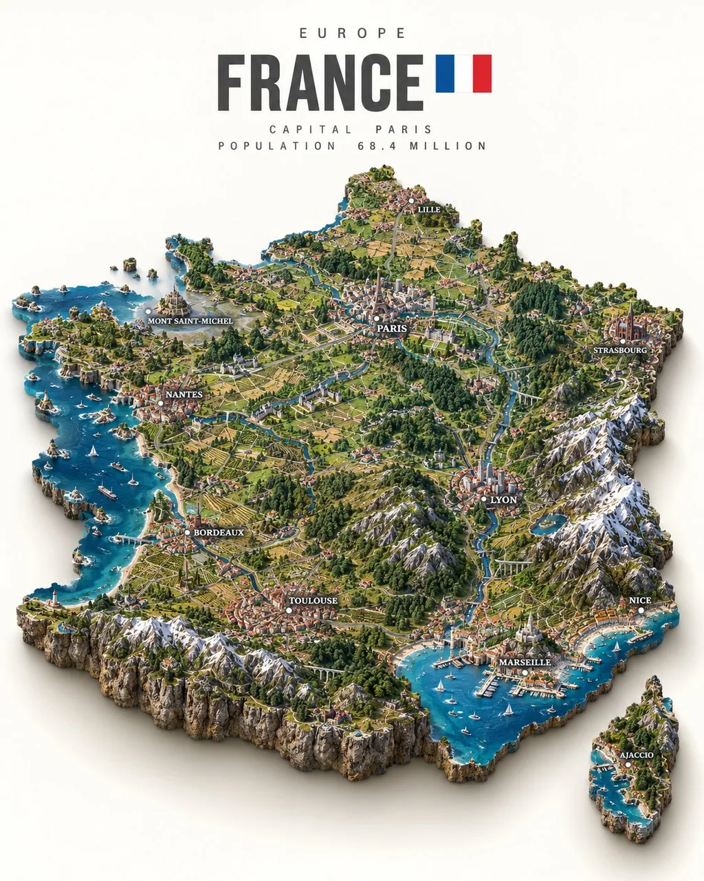
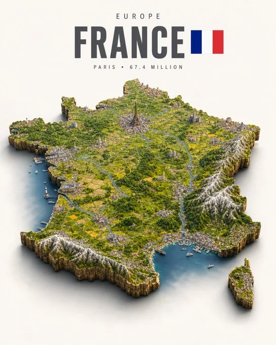
プロンプト
Prompt and images credits @TechieBySA

Simply replace [COUNTRY]:✨

“Ultra-detailed photorealistic isometric miniature scale-model diorama of [COUNTRY], floating on a pure off-white studio background with a soft drop shadow beneath. The diorama takes the exact real-world silhouette shape of the country — not a square tile, but the true precise geographic outline of the country's borders and coastline, extruded downward into a thick slab of raw rock and earth with rough natural cliff-like edges, like a chunk of the real land physically cut out and lifted. The shape of the slab matches the country's actual geography precisely, including any islands, peninsulas or coastline indentations.

The entire top surface faithfully recreates the country's real geography and terrain: mountain ranges with correct elevation and snow coverage, rivers in their real positions, major forests and plains, deserts, coastlines with beaches and cliffs. Every major city is visible as a dense urban cluster in its correct geographic position. The country's most iconic landmarks are rendered in accurate positions and to recognizable scale. Terrain elevation is fully physically modeled — mountain ranges rise dramatically, valleys are sunken, plains are flat, creating real varied 3D topography across the entire surface.

Dense micro-detail: individual buildings in city clusters, tiny roads and highways connecting settlements, railways, bridges, harbors with boats, agricultural field patterns in rural areas, individual trees and forest coverage. Every region has its correct landscape character — the terrain of the north looks different from the south.

Style: hyper-realistic tilt-shift miniature photography — extremely sharp, everything in focus across the whole surface, no blur. Soft warm daylight from above, gentle diffuse shadows, rich natural colors. Lush greens, snow-capped peaks, golden plains, deep blue water along the coastline.

Layout: the shaped diorama floats centered in the lower two-thirds of the frame with clear margins on all sides, never touching the frame edges. Upper third is empty off-white space with minimalist editorial typography, centered: small wide-tracked caps with the continent or region name at the very top, then directly below [COUNTRY] in a bold condensed sans-serif in medium charcoal grey — large and dominant, the biggest text element — with a small flat rectangular flag of [COUNTRY] sitting immediately to the right of the country name, vertically centered with it, accurately colored and proportioned, clean flat design, sized to roughly the cap-height of the country name, floating naturally beside the name as one cohesive unit, not pushed to the far edge but sitting close and attached to the right end of the country name text. Then small wide-tracked caps below with the capital city and population.

Minimalist editorial poster aesthetic, premium print quality, 4:5 aspect ratio.”
日本語訳
Prompt and images credits @TechieBySA

Simply replace [COUNTRY]:✨

“[COUNTRY] の超詳細フォトリアルなアイソメトリック・ミニチュアスケールモデル・ジオラマ。純粋なオフホワイトのスタジオ背景に浮かび、その下には柔らかなドロップシャドウ。ジオラマはその国の実世界そのままのシルエット形状をとる — 正方形のタイルではなく、国境と海岸線の真に正確な地理的輪郭を下方へ押し出し、粗い自然な崖のような縁を持つ厚い岩と土のスラブにしたもの。実際の土地の一片を物理的に切り出して持ち上げたような塊。スラブの形状は、島々や半島、海岸線の入り込みも含め、その国の実際の地理と正確に一致する。

上面全体はその国の実際の地理と地形を忠実に再現する:正しい標高と積雪をともなう山脈、実際の位置にある河川、主要な森林と平原、砂漠、ビーチと崖をともなう海岸線。主要な都市はすべて、正しい地理的位置に密集した都市クラスターとして見える。その国を最も象徴するランドマークは、正確な位置に、認識できるスケールで描かれる。地形の高低差は完全に物理的にモデリングされる — 山脈は劇的にそびえ、谷は沈み、平原は平坦で、表面全体にわたって本当に変化に富んだ 3D トポグラフィーを生み出す。

緻密なマイクロディテール:都市クラスター内の個々の建物、集落をつなぐ細い道路と高速道路、鉄道、橋、船を浮かべた港、農村部の農地のパターン、一本一本の木と森林の広がり。各地域はそれぞれ正しい景観の性格を持つ — 北部の地形は南部とは違って見える。

スタイル:超リアルなチルトシフト・ミニチュア写真 — 極めてシャープで、表面全体にピントが合い、ぼけはない。上方からの柔らかく暖かな日中の光、穏やかで拡散した影、豊かで自然な色彩。青々とした緑、雪を頂く峰、黄金の平原、海岸線に沿った深い青の水。

レイアウト:成形されたジオラマはフレームの下三分の二の中央に浮かび、四方に明確な余白を残して、フレームの端には決して触れない。上の三分の一は何もないオフホワイトの空間で、ミニマルなエディトリアル・タイポグラフィを中央揃えで配置:最上部に小さなワイドトラッキングの大文字で大陸または地域名、そのすぐ下に [COUNTRY] を太字のコンデンスド・サンセリフ、ミディアムチャコールグレーで — 大きく支配的に、最大のテキスト要素として — さらに [COUNTRY] の小さな扁平な長方形の国旗を国名のすぐ右に置き、国名と垂直中心を揃え、正確な配色と比率、クリーンなフラットデザイン、国名のキャップハイト程度のサイズで、名前の横に一つのまとまりとして自然に浮かべる。遠い端へ押しやるのではなく、国名テキストの右端に寄り添い接するように。その下に小さなワイドトラッキングの大文字で首都と人口。

ミニマルなエディトリアルポスターの美学、プレミアムな印刷品質、4:5 アスペクト比。”
出典
- 原作者
- abxxai
- 公開日
- 2026-09-09
- 原典
- 元の投稿を見る ↗
- 収録元
- xianyu110/awesome-gpt-image2.5 · 2097651231569399814 · MIT