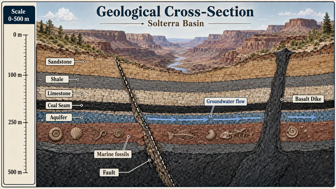
Produce a detailed geological cross-section poster of layered earth strata cutting through a fictional canyon basin. Use a natural scientific palette of sandstone beige, iron oxide red, shale gray, limestone cream, basalt charcoal, and muted green vegetation above ground. Show clearly differentiated layers, a fault line, an aquifer, fossil-bearing beds, and a volcanic intrusion. Add crisp in-image text: "Geological Cross-Section", "Solterra Basin", "Scale 0-500 m", and labels "Sandstone", "Shale", "Limestone", "Coal Seam", "Aquifer", and "Basalt Dike". Include a vertical scale with "0 m", "100 m", "250 m", and "500 m". Add small annotations "Marine fossils" and "Groundwater flow" with arrows. The composition should be highly legible, educational, and neatly diagrammed, with clean linework, correct label placement, balanced annotation density, and publication-quality scientific illustration clarity.
한국어 번역
층을 이룬 지층이 가상의 협곡 분지를 가로지르는 상세한 지질 단면 포스터를 제작하세요. 사암 베이지, 산화철 적색, 셰일 회색, 석회암 크림, 현무암 차콜, 지상의 차분한 녹색 식생으로 이루어진 자연과학 팔레트를 사용하세요. 뚜렷하게 구분된 지층, 단층선, 대수층, 화석 함유 지층, 화산 관입암을 보여주세요. 이미지 내에 또렷한 텍스트 "Geological Cross-Section", "Solterra Basin", "Scale 0-500 m"와 라벨 "Sandstone", "Shale", "Limestone", "Coal Seam", "Aquifer", "Basalt Dike"를 추가하세요. "0 m", "100 m", "250 m", "500 m"가 있는 수직 축척을 포함하세요. 화살표와 함께 "Marine fossils"와 "Groundwater flow"라는 작은 주석을 추가하세요. 구도는 매우 읽기 쉽고 교육적이며 깔끔하게 도식화되어야 하고, 깔끔한 선, 정확한 라벨 배치, 균형 잡힌 주석 밀도, 출판 수준의 과학 일러스트 명료성을 갖추어야 합니다.