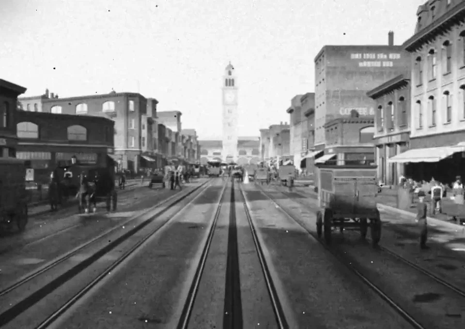
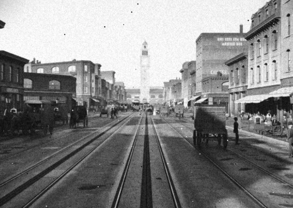
Recreate Market Street, San Francisco as it stood on April 17, 1906, the afternoon before the earthquake, in Blender.

Scope: the Ferry Building up Market to Fifth Street, including the Palace Hotel, the Call Building, the Chronicle Building, Lotta's Fountain and the Emporium.

Before modeling anything, build a source file from: the 1899-1905 Sanborn fire insurance maps (footprints, heights, materials, occupants), the Miles Brothers film "A Trip Down Market Street" (April 1906), period photographs from OpenSFHistory, the Library of Congress and the David Rumsey collection, and USGS topography. Record every building with footprint, height, facade material, occupant, and the source for each fact with a confidence level.

Build everything in Blender Python. No downloaded meshes, textures or HDRIs. Write reusable generators (Victorian commercial facade, mansard roof, bay windows, awnings, painted signage, gas and electric street lamps, cable car, horse-drawn wagon, early automobile) and assemble the street from the source file, so every building traces back to data.

Provide a 10 second video up the street.
한국어 번역
Blender에서 1906년 4월 17일, 지진이 일어나기 전 오후의 샌프란시스코 Market Street를 그날의 모습 그대로 재현하세요.

범위: Ferry Building에서 Market Street를 따라 Fifth Street까지의 구간이며, Palace Hotel, Call Building, Chronicle Building, Lotta's Fountain, Emporium을 포함합니다.

무엇이든 모델링하기 전에 다음 자료로 소스 파일을 구축하세요: 1899-1905년 Sanborn 화재 보험 지도(건물 윤곽, 높이, 재료, 입주자), Miles Brothers의 영화 "A Trip Down Market Street"(1906년 4월), OpenSFHistory, Library of Congress, David Rumsey 컬렉션의 시대 사진, 그리고 USGS 지형 자료. 모든 건물을 건물 윤곽, 높이, 입면 재료, 입주자, 그리고 각 사실의 출처와 신뢰도 수준과 함께 기록하세요.

모든 것을 Blender Python으로 구축하세요. 다운로드한 메시, 텍스처, HDRI는 사용하지 마세요. 재사용 가능한 생성기(빅토리아 양식 상업용 입면, 맨사드 지붕, 베이 윈도, 어닝, 페인트로 그린 간판, 가스 및 전기 가로등, 케이블카, 마차, 초기 자동차)를 작성하고, 소스 파일로부터 거리를 조립하여 모든 건물이 데이터로 추적되게 하세요.

거리를 따라 올라가는 10초 영상을 제공하세요.